
Deception Pass State Park is one of busiest state parks in Washington. It's not hard to see why. The two-span Deception Pass Bridge offers spectacular views, there are beaches with sand dunes, and miles of trails snake through the woods.
Interestingly, Deception Pass — which separates Fidalgo Island and Whidbey Island, and connects Puget Sound and the Juan de Fuca Strait — was named by Captain George Vancouver in 1792. It lies in the traditional territories of the Samish and Swinomish tribes.
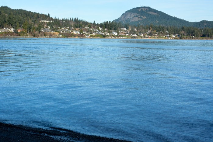 Mount Erie from Hoypus Point. Photo: Stephen Hui.
Recently, I travelled 150 kilometres from Vancouver to hike a short loop in the park's Hoypus Point Natural Forest Area on Whidbey Island. Our easy route first took Cornet Bay Road to the point, then followed the East Hoypus Point Trail up Hoypus Hill. The Hoypus Hill Logging Road led to the Julie Trail, Fern Gully, Little Alder Trail, and Fireside Trail. Finally, the West Hoypus Point Trail delivered us back to Cornet Bay Road and the trailhead.
From Hoypus Point, the view includes Mount Erie in Anacortes and Mount Baker (Kweq’ Smánit) on the mainland. Old-growth Douglas-fir trees are another highlight of the area. The peace of the forest is periodically interrupted by noisy U.S. Navy jets from Naval Air Station Whidbey Island.
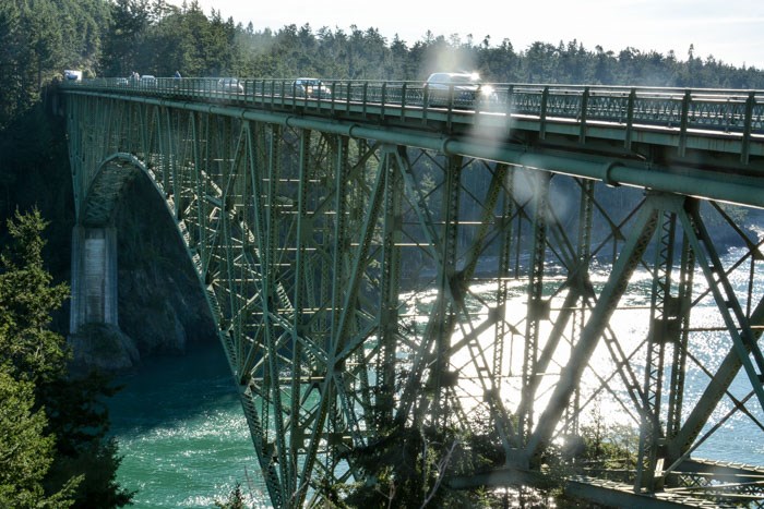 Deception Pass Bridge from Pass Island. Photo: Stephen Hui.
Our hike took almost 3.5 hours, covered 11 kilometres, and involved a minuscule elevation gain of 130 metres. On our way out of the park, we stopped to savour views of the iconic Deception Pass Bridge from West Point and Pass Island.


