
 Environment and Climate Change Canada's National Wlidfire Smoke Model
Vancouverites woke up to hazy skies this morning and the province's Air Quality Health Index rates most of Metro Vancouver at 10+ on a scale of 10, which is considered to be a very high risk.
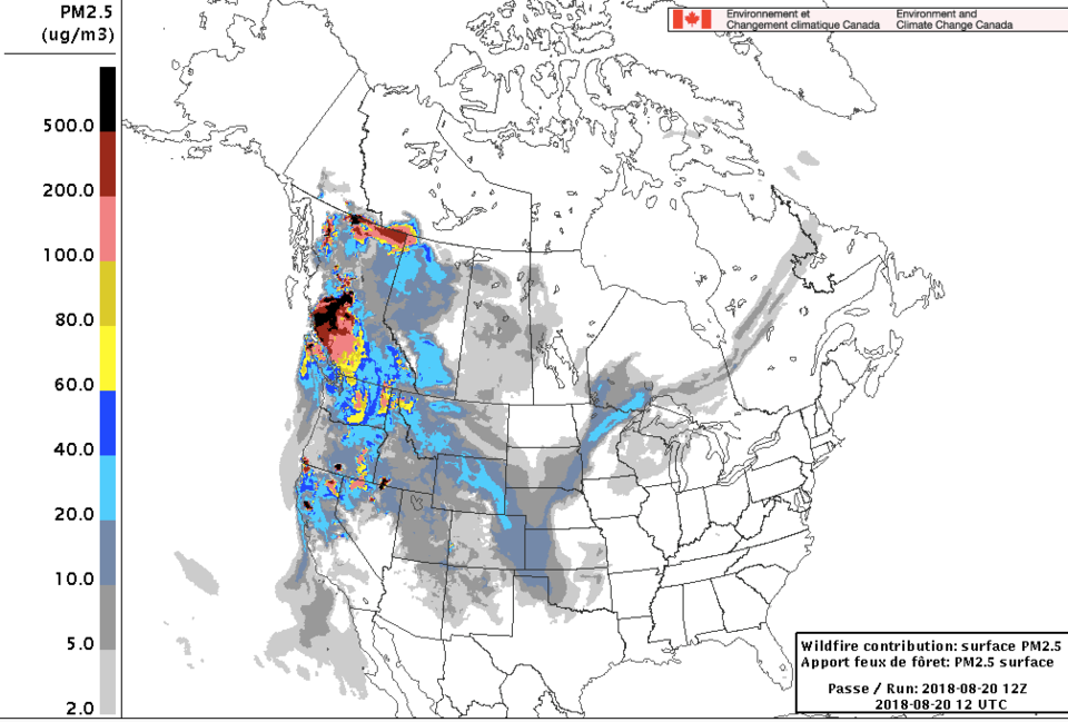
Smoky skies will continue across most of the province for the next few days, according to Environment Canada. Check out the National Wildfire Smoke Model to see how the smoke is expected to move over the next 48 hours and drift into other provinces.
On Sunday, Metro Vancouver announced that it would continue a previous air quality advisory due to high levels of particulate matter, which are tiny solid or liquid particles in the air that can negative health effects.
Current smoke situation in #Vancouver -- normal view from the lab vs. today's view ? pic.twitter.com/YSXDQCpVfu
— Point Mutation (@Point_Mutation) August 20, 2018
The elderly, children or those with pre-existing health conditions are advised to stay inside and avoid strenuous outdoor activity, especially if they experience symptoms such as coughing or throat irritation.
Vancouver Coastal Health's Tiffany Akins says they're not seeing a marked increase in patient admissions but the The Pacific Lung Health Centre at St. Paul's Hospital has experienced a 20 per cent increase in calls from people that have existing conditions such as asthma.
For real-time air-quality measurements see the Air Quality Index and the Lower Fraser Valley Air Quality Monitoring Network's AirMap.
There are about 550 wildfires burning across B.C. and 54 are considered to pose a threat to public safety. The BC Wildfire Service has a map showing the locations of all active wildfires in the province.


