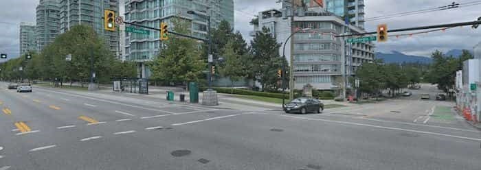
 Intersection at West Georgia Street & Cardero Street (Google Maps)
Leadfoots beware: the Government of British Columbia is cracking down on dangerous driving this summer with an automatic ticketing system.
What's more, the system will issue a ticket regardless of whether a driver has sped through a red, yellow, or green light. So, the message is pretty clear - you speed, you lose.
Using an analysis of 140 Intersection Safety Camera (ISC) program sites currently equipped with red-light cameras, the government has identified 35 with the greatest potential for further safety gains through automated speed enforcement; 12 of the intersections are located in the City of Vancouver.
Starting this summer, B.C. will install new warning signs and activate technology to ticket the registered owners of vehicles entering these intersections well above the speed limit.
“We have a record number of crashes happening – more than 900 a day in our province – and about 60% of the crashes on our roads are at intersections,” said Mike Farnworth, Minister of Public Safety and Solicitor General.
“We’ve taken time to systematically pinpoint the locations linked to crashes and dangerous speeds that are best suited to safely catching, ticketing and changing the behaviours of those who cause carnage on B.C. roads.”
With that being said, Farnworth notes that officials won't disclose how much someone has to speed over the limit in order to get ticketed; they are intentionally leaving that part ambiguous in order to deter people from going over the limit at all.
Also, Farnsworth stated that the speed threshold may change over time as the program continues to be monitored and evaluated.
Automatic Ticketing Locations
- Route 11 at Lonzo Road
- Boundary Road & Kingsway
- Royal Oak Avenue & Kingsway
- Deer Lake Parkway & Willingdon Avenue
- British Columbia 7A & Mariner Way
- Cooper Road & Harvey Avenue
- Banks Road & Highway 97 North
- 64 Avenue & 200 Street
- British Columbia 10 & Fraser Highway
- British Columbia 7 & 207 Street
- British Columbia 19 & Aulds Road
- Marine Drive & Capilano Road
- British Columbia 7 & Old Dewdney Trunk Road
- Shaughnessy Street & Lougheed Highway
- Cambie Road & Garden City Road
- 88 Avenue & 128 Street
- 96 Avenue & 152 Street
- King George Boulevard & 152 Street
- 152 Street & 64 Avenue
- 96 Avenue & 132 Street
- King George Boulevard & 104 Avenue
- King George Boulevard & 80 Avenue
- East 49th Avenue & Boundary Road
- Main Street & East Hastings Street
- Renfrew Street & East Hastings Street
- Grandview Highway & Rupert Street
- Granville Street & West King Edward Avenue
- Joyce Street & Kingsway
- Kingsway & Victoria Drive
- Knight Street & East 33rd Avenue
- West 57th Avenue & Oak Street
- West 70th Avenue & Oak Street
- Kerr Street & Southeast Marine Drive
- West Georgia Street & Cardero Street
- 84 Avenue & Nordel Way
Between 2012 and 2016, ISC sites in B.C. reported an average of 10,500 vehicles a year going at least 30 kilometres per hour over the posted speed limit, as detected by red-light cameras, which also monitor vehicle speeds. Speed has been one of the top contributing factors in casualty crashes at these intersections, which have had a combined total of more than 11,500 collisions per year.