
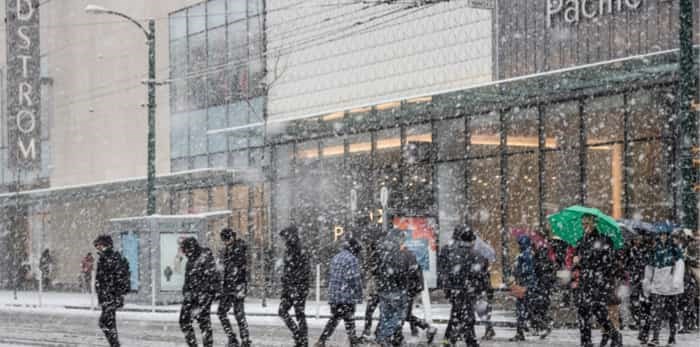
 Snow storm in Downtown Vancouver, Canada / Shutterstock
Last week, the Metro Vancouver weather forecast called for a "chance of rain showers or flurries" along with some chilly overnight lows.
While the region didn't see any flurries, a new cold weather system has moved into the region. Now, Environment Canada calls for a chance of flurries later in the week.
The forecast notes that the region will see a transition to colder conditions as arctic air reaches the coast by Wednesday night. In addition, most coastal communities are expected to see temperatures drop below the freezing mark, and blustery outflow winds will yield cold wind chill values.
Tuesday's forecast calls for a chance of showers during the morning, however, the skies are expected to clear by the afternoon. Following this, Wednesday is expected to see bright sunshine and a high of 6°C during the day and a low of 0°C overnight.
Thursday through Saturday is expected to be bright and sunny, with frigid overnight lows. And, while Sunday's forecast calls for sunshine during the day, the evening calls for a 60% chance of flurries and a low of -2°C.
Metro Vancouver Weather Forecast
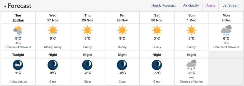 Photo: Environment Canada
Back in September, The Weather Network predicted that British Columbia would have a milder winter, but that December was a “wild card.”
Since then, the winter forecast has been updated to include the most recent prediction, which calls for milder temperatures along the B.C. coast and across much of Northern B.C. While northeastern B.C. to the southern interior will see near normal temperatures.
While the north coast region is, “expected to see above average rainfall and alpine snow,” the south coast region is expected to be drier than normal. With this in mind, the forecast adds that this dry pattern may break at times during the season. During these breaks, the Lower Mainland could have the, “potential to see several weeks’ worth of precipitation in just 5 to 10 days.”


