UPDATE: 1:25 p.m.
Twelve properties near the Flood Falls fire have been issued evacuation orders Saturday, as the large fire continues to grow.
The Fraser Valley Regional District and the District of Hope issued the order for parts of the Laidlaw area near Hope, due to the danger presented by the large fire.
Fire information officer Paula Walbauer said the orders were put in place due to concerns about getting people out of the areas if the fire continues to grow.
“Not saying that the fire is closer to those homes but making sure that they are able to get out in the event of reduced visibility and fire behaviour,” Walbauer said.
Additional evacuation alerts remain in place for areas south of the Trans-Canada Highway.
The fire appears to spreading to the west at this time, away from Hope.
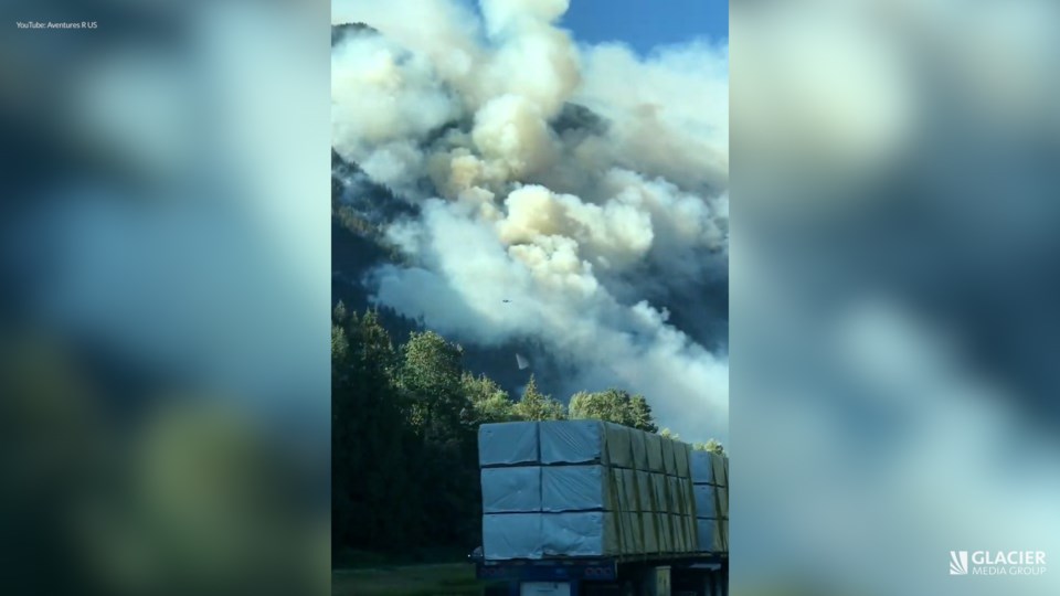
The eastbound lanes of the highway remain closed through the area, and travellers must detour through Agassiz using Highway 9 and 7. Westbound traffic remains open on Highway 1 for the time being.
The fire is currently estimated at 458 hectares in size.
UPDATE: 10:35 a.m.
The large fire burning southwest of Hope has now forced the partial closure of nearby Highway 1.
All eastbound traffic from Annis Road to Flood Hope Road is now being redirected through Highway 9 and 7, through Agassiz, "due to nearby wildfire activity" according to DriveBC. Westbound traffic can still use Highway 1 through the area for now.
The fire has grown substantially in the past day, to an estimated 458 hectares. The recent growth led to an expansion of the evacuation alert for homes in the area.
ORIGINAL: 9:30 a.m.
The wildfire burning near Hope has ballooned to an estimated 458 hectares in size, and the evacuation alert in the area has expanded.
The Flood Falls fire was sparked Thursday evening southwest of Hope, in the steep terrain above the Trans-Canada Highway.
While the BC Wildfire Service estimated the fire to be just 50 hectares in size on Saturday, the latest estimate is more than nine times that.
“Due to hot, dry conditions and gusty winds, increased fire behaviour will be visible today,” the BCWS says in its latest update on the fire.
“This fire is burning is very steep terrain presenting access challenges for ground crews. Helicopters are focusing on bucketing the east and west flanks of this fire.”
Saturday night, the District of Hope and the Fraser Valley Regional District expanded their evacuation alert to the west, through the Hunter Creek area to the Laidlaw areas.
“Prevailing winds have pushed the Flood Falls Trail wildfire to the west, increasing risk to the Laidlaw community,” the District of Hope posted Saturday night.
“This alert is a precautionary measure to ensure Laidlaw residents are aware of the fire risk and are prepared for excavation if it becomes necessary.”
Firefighters are working to protect the nearby Trans-Canada Highway and other homes and infrastructure in the area
“Values at risk include residences and infrastructure within District of Hope, Highway 1, Trans Mountain Pipeline [and] Hunter Creek Hydro Project,” the BCWS says.
There are now 54 BCWS firefighters working on the fire, along with support from the Hope Fire Department. Six helicopters are also helping with suppression.
The fire is suspected to be human-caused.