
Snowfall mixed with ice pellets, then freezing rain and heavy rain are forecast for southern B.C. including Greater Victoria until at least Christmas Eve on Saturday, Environment Canada says. Strong winds are also part of the stormy weather mix, which could mean near-zero visibility at times.
The weather whammy could close highways, knock out power, and lead to the scaling back or cancelling of ferry, bus and flight services, officials said. Flooding could occur when heavy rain falls while drains are still blocked by ice and snow.
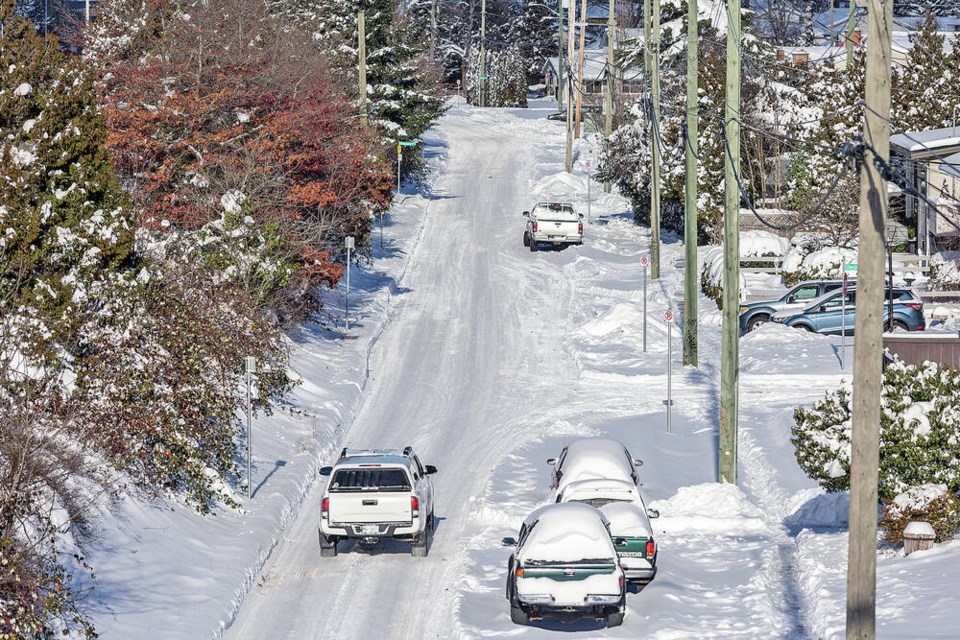
Some parts of the southern Island could see 10 to 20 centimetres of snowfall, which was expected to begin late Thursday.
At Victoria International Airport, most Friday morning departures have been cancelled in anticipation of icy conditions.
B.C. Ferries said there is a “strong possibility” of sailing cancellations through Saturday night. Several round-trip sailings on Friday morning were cancelled, including on the Tsawwassen-Swartz Bay run. Sailing updates are at bcferries.com.
B.C. Transit said there’ll be no bus service on Friday until at least 1:30 p.m., when the road situation will be reassessed. Check for service updates at bctransit.com.
On Thursday, it had 25 of its 57 Greater Victoria routes operating, although many were subject to detours and they were not running to a schedule. Service was to be halted by midnight, except for a bus meeting the last ferry at Swartz Bay.
The freezing rain is a particular concern, causing strain on power lines and making roads even more slippery than they already were from Tuesday’s snowfall.
B.C. Hydro said it’s preparing for the possibility of significant damage to its power system in coming days, noting freezing rain has the most potential to cause problems.
“All available B.C. Hydro crews, contractor crews, vegetation-management crews and other support staff are on standby,” said spokesperson Susie Rieder. “However, road conditions are expected to be challenging and visibility is expected to be poor at times, which could slow down the response times.”
Ice build-up could cause trees branches to become brittle and break, falling onto power lines and equipment.
B.C. Hydro encouraged the public to have an emergency kit at home with water, a flashlight and batteries, and enough food to last 72 hours.
Anyone seeing a downed power line should stay at least 10 metres away — about the length of a bus, B.C. Hydro said.
Transportation and Infrastructure Minister Rob Fleming said travel by road on Vancouver Island, the south coast, or to and from the Interior should be avoided “unless absolutely necessary.”
The significance of the incoming weather front can’t be overstated, Fleming said.
Up to 25 centimetres of snow is expected in parts of the Lower Mainland through Friday and strong easterly winds could result in near-zero visibility in some areas.
“Rarely do we see such heavy snowfall followed by freezing rain and heavy rainfall. We want everyone to remain safe,” Fleming said at a news conference.
Contractors were preparing for heavy snow with more than 100 pieces of equipment, Fleming said.
The ministry may proactively close highways in the interest of safety, he said.
“I know people have plans for the holidays. They want to spend family time with family, friends and loved ones. But this is a significant weather event.”
Environment Canada meteorologist Trevor Smith described the weather as “a clash of the titans” between an arctic air mass that has been keeping things cold and Pacific air that is on its way.
“It’s basically that transition from the arctic air to the Pacific air, this battle, that’s going to kind of produce all this nasty weather,” he said.
“And eventually the Pacific air will win out by later on Saturday for the most part, so we’ll be all-in to rain. But it’s that intervening period [Thursday and Friday] where we’re going to see all these different precipitation types.”
Snow is expected to change to rain by late Friday over most of Vancouver Island, although freezing rain could continue into Saturday afternoon in inland areas.
The wind chill could be down to - 25 C.
A fallen tree, linked to the weather, closed Highway 14 in both directions Thursday between Jordan River and Port Renfrew. There was debris between Cerantes Road and Jordan River Recreation site, according to Drive B.C.
Early today, that section of highway was opened to alternating single-lane traffic.
The Pacific Marine Circle Route offers an alternative out of Port Renfrew through Lake Cowichan and Duncan.
Port Renfrew Chamber of Commerce president Karl Ablack said anything blocking Highway 14 has an immediate effect on the community, cutting off access into Sooke and Victoria.
>>> To comment on this article, write a letter to the editor: [email protected]


