
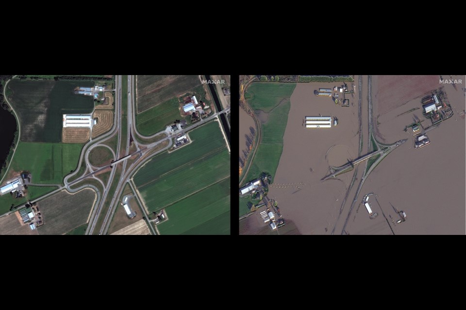
Satellite imagery collected by a U.S.-based company shows just how widespread the floodwaters in the Sumas Prairie region of Abbotsford are.
The photos were collected on Nov. 19 by Maxar, a satellite firm headquartered in Colorado.
Some of the pictures show what the farmland and roads looked like before the floods hit, followed by an 'after' photo.
The Sumas Prairie is currently under a 'Do Not Use Water Advisory.' On Wednesday, Mayor Henry Braun said the water contains a mixture of toxins, including fertilizer, gasoline, dead animals and plant matter. He explained the water is only useful for flushing toilets.
Meanwhile, the province had some good news to share Wednesday. It hopes to reopen Highway 1 through the Fraser Valley Thursday. Right now, crews continue to clear debris from the road.
It's unclear if this portion of highway, connecting Abbotsford and Chilliwack, will be open for essential travel only.
With a file from Nicholas Johansen


