
If you've ever driven along Lougheed Highway, you've probably been stopped in traffic or gazed at the ribbon of SkyTrain track along much of its route.
Whether you drive to Coquitlam, Port Coquitlam, Burnaby and Maple Ridge, you'll have taken this route, also called Highway 7, which is an alternative route to Highway 1 through the Lower Mainland region of British Columbia.
The drive isn't very exciting, the road is fairly straight, except where it takes a hard right in Coquitlam, landmarks are mostly big box stores, like Costco and IKEA, but the highway gets you where you want to go.
Along the way are gas stations, interspersed with low-rise development, and every now and then high rise towers loom over SkyTrain stations at Brentwood, Lougheed Mall, and Coquitlam Town Centre.
But 50 years ago Lougheed Highway was a strip of pavement, mostly lined with trees, and traffic was, let's just say "minimal," compared to today.
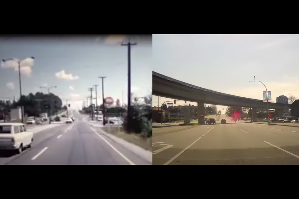
A Then and Now video of the route from Burnaby to Maple Ridge, posted on YouTube by Port Moody resident Dave Zille, shows how the highway has changed in 50 years.
"It (the old highway) felt like a country road," says Zille, a local history buff, who also work in the tech industry.
@tricitynews Then 🆚 Now. #tricitynews #coquitlam #portcoquitlam #portmoody #countryroads #throwback #takemebacktuesday ♬ Take Me Home, Country Roads - Cicci Guitar Condor & Gruppo New Condor
Zille put together a side-by-side video of Lougheed Highway, with film footage from 1966 taken by the B.C. Ministry of Transportation and Infrastructure and his own dash cam video, taken in 2020.
"It was a real challenge to put together a side-by-side comparison," acknowledged Zille.
Among the issues he had to deal with was to slow the ministry's video down so he could see the landmarks and intersections and figure out the old road alignment.
There were some tricky spots, Zille said, for example, Lougheed Highway in Coquitlam used to follow what is now Westwood Street in Port Coquitlam.
"It was a matter of finding the landmarks that are recognizable, such as bridges and intersections, and using those as sort of markers and trying to line the things between what you do know."
Among the changes that stood out to Zille was the lack of traffic in 1966, and development along the route, such as the various stores.
Many of the gas stations remain in their original location, and those frustrated with the old Coquitlam River Bridge in Port Coquitlam might not be too surprised to see the bridge hasn't changed at all.
The city has been seeking funding to replace this bridge, which was built in 1949, for ages.
Zille has made similar match-up videos for other highways in B.C., including St. Johns Street and Ioco Road in Port Moody.
For his entire Then and Now playlist, visit his YouTube channel.


