
Arguably the biggest two events in Vancouver's last 50 years, Expo 86 and the 2010 Olympics both had a huge impact on the city and, in particular, the eastern end of False Creek.
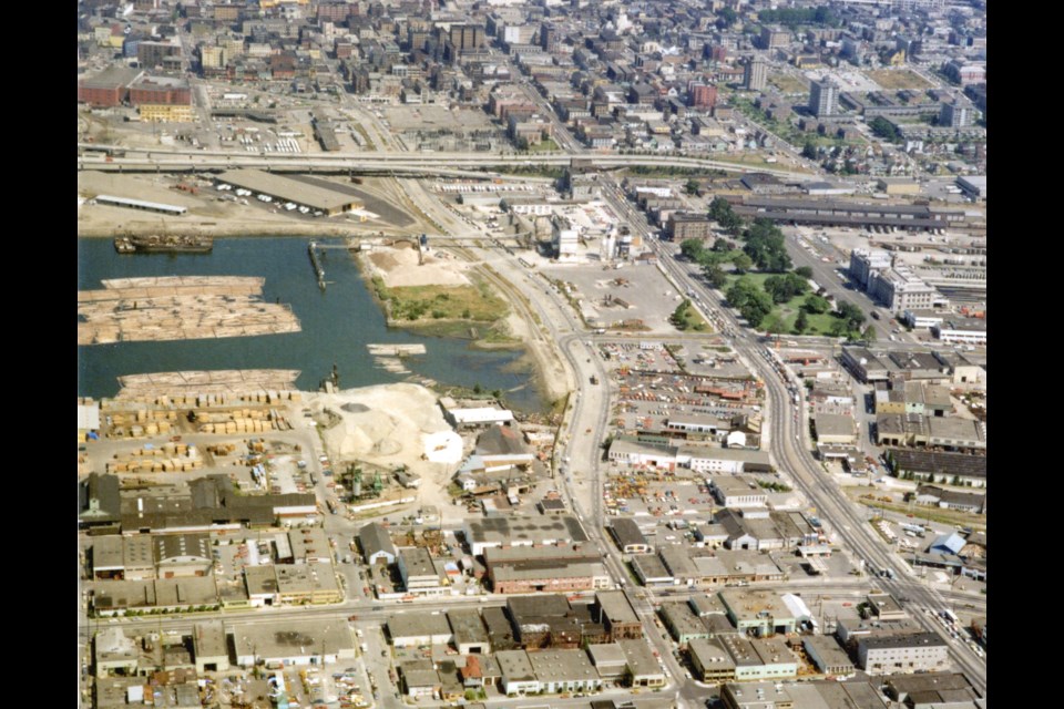
False Creek had been an industrial area for decades when Expo 86 was proposed; the land was home to the CPR railyard, warehouses, and manufacturing while the water saw log booms and pollution more often than tourists.
At some point in the 1970s, before the world's fair was officially proposed in 1979, the city had photos taken from the air of the lands around False Creek, with several capturing just what the area looked like before it was transformed.
Industrial buildings of all sorts can be seen, with large, low structures covering much of the area.
The amount of development that's occurred in the area is staggering when compared with photos of the same location taken less than 50 years ago.
Perhaps the biggest change isn't one particular structure, but the huge number of condo towers that have sprung up. In the 1970s none of them existed. In many of the photos the towers of downtown or on Broadway dwarf anything in the foreground.
Lots of very notable specifics are missing too, many of them icons of the city now. BC Place, Science World and the Skytrain are all essential and very recognizable to locals and visitors now, but in the 1970s they didn't exist. BC Place's place was part of the railyard, while an unhappy beach sits where Science World is now.
At the time, and for decades prior, lumber was what built Vancouver (economically, but not so much literally) and that's evident in these photos as well. There are a lot more trees in False Creek than growing next to it in these photos, and piles of wood can be seen in some of the lots.


