
Everyone knows a few basic things about Vancouver's geography and geology.
Like how it lies on the west coast of Canada, is a port city with access to the Pacific Ocean, and how it's location means it's the warmest big city in Canada.
However, there are a few secrets to Vancouver's location that are probably a bit unexpected.
1. Vancouver is in eastern B.C.
This may sound completely wrong, but take a look at a map of B.C. and find the most extreme points.
Because of B.C.'s odd shape, these are actually very far apart. In the southeast you have a tiny corner of Akamina-Kishinena Provincial Park jutting east to 114.05424 West. In the northwest, if you go all the way past Skagway to Tatshenshini-Alsek Provincial Park you'll be at 139.05702 West.
Vancouver is at 123.2123 West, and that's picking from the western side from the city. Some quick math will show Vancouver is closer to the eastern point than the western point.
And if our math isn't good enough, there's a cairn at the geographic middle of B.C., near a place called Weneez just outside of Vanderhoof. Draw a line directly south from there and you hit Nanaimo, not Vancouver.
2. Population-wise, Vancouver is in northern Canada
Before posting an angry comment, please take a moment for context.
No, from a straight-up, global perspective, Vancouver is not in northern Canada.
But, if you're using Canada's population to determine a mid-point of the nation, Vancouver is well north of that line.
While it's a warmer part of the country, and tucked nice and close to the 49th parallel, Vancouver is actually north of a lot of other Canadian cities. Toronto is of course a notable one, with the millions of people that live there, but so is Ottawa, Montreal and even St. John's. In fact, the Maritimes are all south of the 49th (that's right, the maritime and prairie provinces don't share a latitude).
Other cities south of the 49th include Sudbury, Ontario (often referred to as the largest city in Northern Ontario), Quebec City and B.C.'s own Victoria (along with a lot of people on the southern Island).
The flip side of that is how sparse northern Canada is compared to the rest of the country. While going quite a ways north, only about 118,000 people live in the territories; that's smaller than greater Nanaimo.
3. Vancouver Island and Vancouver get closer and further from each other
Let's preface this by noting that plate tectonics is not a simple branch of science.
Everyone knows what earthquakes are, but there's another, similar thing tectonic plates do called 'episodic tremor and slip events' (ETS events).
Most of the time Vancouver and Vancouver Island are moving closer to each other, though only by tiny amounts measured in millimeters.
But then there are these ETS events, which are more like a series of slips instead of a jolting moment. In this area they happen ever 14 of 15 months, and over a few weeks the island backs away from the mainland, before once again getting closer.
4. Vancouver's volcanic Little Mountain
This one is simple; Vancouver's Little Mountain has a volcanic history.
Don't worry, it's not a volcano (and never was), but it is made of lava and/or magma. Western B.C. had a lot of volcanic activity back in the day, and as part of that, around 31 to 34 million years ago, the hill formed.
What exactly happened is unclear, but in general it was created by magma flowing up through the layers of the Earth. From there it's unclear if it stayed underground as magma, and then the rest of the land was eroded away, or if it broke the surface to become a lava flow. In either case, what's there now used to be liquid rock just over 30 million years ago.
For those wondering what volcanic rock looks like, there's a house on Cambie that was was designed around a volcanic outcrop that sits there to this day.
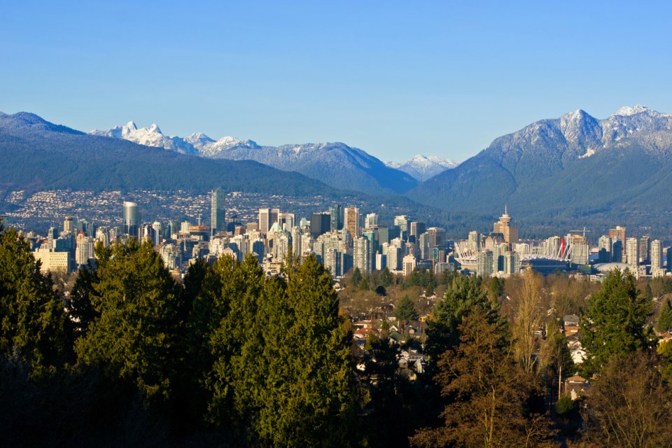
5. The highest point in Vancouver is the top of Queen Elizabeth Park
It may not come as a big surprise that the highest point of Vancouver is on top of Little Mountain, especially with Queen Elizabeth Park boasting some of the best sightlines in the city.
What's more surprising is second place. A city topographical map shows that an area of Boundary Road near Burnaby's Central Park is the second-highest spot in the city. When driving past the Korean War Memorial in the park, you're also more than 120 metres above sea level.
Third place is a section of Price Street between Boundary Road and Joyce Street.


