
Ever wondered what ship you can see from the seawall? Or what's anchored out in English Bay? Or which superyacht is floating down False Creek?
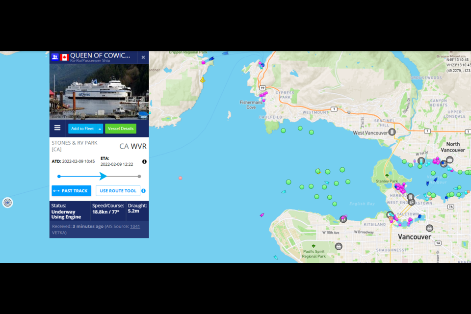
That's where this map might come in useful. Run by MarineTraffic, it tracks ships using their automatic identification system (AIS) GPS, an automatic international system to keep track of the world's shipping fleets. If a marine vessel has it turned on, it's on the map.
It's not just for massive freighters, everything from huge tankers to tiny tugboats are on there. In Vancouver that includes the SeaBusses running from Canada Place to the North Shore and other tour boats around town (the False Creek Creek ferries aren't on there).
There are also a lot of magenta dots representing the sizable pleasure craft fleet in and around Vancouver, though, since ships can turn off the AIS GPS and that's often done while docked, not all are on the map at any given time.
While freighters visiting Vancouver are a very visible portion of the local marine traffic, the map shows how busy the local tugboat industry is, with ships showing everywhere, including plenty on the Fraser River all the way up to Mission.
There are a fair number of fishing boats in the area, though if you scroll out from Vancouver to look at the globe, the local number is dwarfed by some of the fleets operating elsewhere in the Pacific.
The rarest type of boat appears to be high-speed craft; currently there aren't any mapped around Vancouver. The closest is north of Victoria, with a few more in Puget Sound.


