
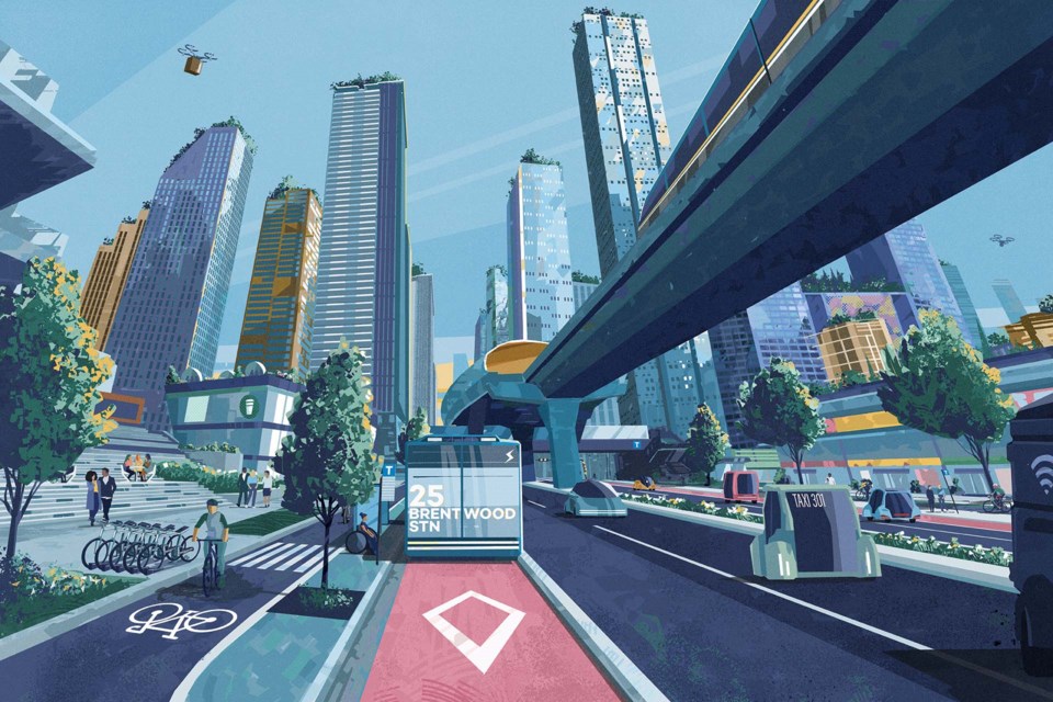
A series of new images aim to represent what Metro Vancouver could look like once TransLink's latest transportation strategy is in place in 2050.
After three years in development TransLink's new regional transportation strategy: Transport 2050 aims to improve transportation for people in Metro Vancouver through several avenues. Key among them is promoting electric and shared vehicles, dedicating more streets to self-powered transport and transit, creating an 850-kilometre major bikeway network and putting rapid transit within a short walk of most people.
Earlier this week the transit provider released illustrations of what major and local streets as well as major boulevards or urban centres could look like once the strategy is complete.
To learn more about Transport 2050 you can check out TransLink's website or our previous coverage of the strategy.


