
Usually, when maps are made out of trees they're paper, but not this one.
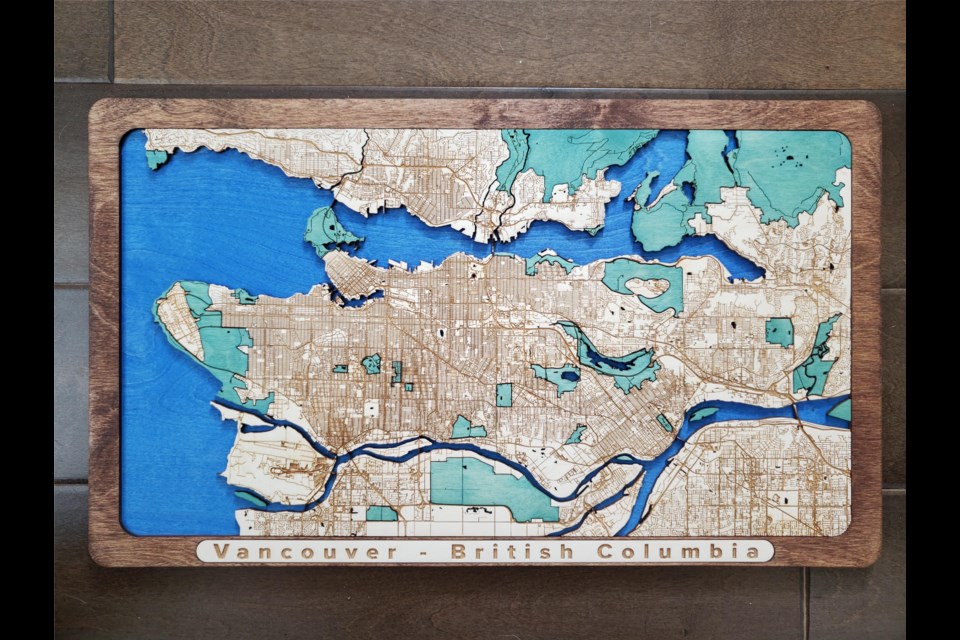
Raymond Inzitari is a designer who's put his expertise in maps and woodwork to good use making maps with streets and features cut into the wood with lasers. For his creation of Vancouver he used two layers of wood, one for land and one for water.
"The road network is laser engraved on the top piece, while the bottom piece is dyed blue," he writes on Imgur. "Then all of the rivers & lakes are cut away to expose the blue underneath. The green pieces are cut out completely (before they're green), sanded off, dyed green, then put back in."
The map includes most of Metro Vancouver as well, like Richmond and Coquitlam.
Using the two layers and a laser cutter he creates a 3-d feel to the map.
To make wooden maps he uses mapping software, his own software, laser cutters and his own hands (with tools).
Vancouver wasn't his first map, Inzitari sells them. He's created similar maps of major American cities like Seattle and New York, along with a few cities outside of North America.


