
Thousands of Vancouver Island residents are without power due to snow and freezing rain.
As of 11:15 a.m., B.C. Hydro was reporting 129 outages on the Island, affecting almost 50,000 customers. A list of all the outages can be seen on the B.C. Hydro website.
Power outages are reported in areas of Highlands, Saanich, Colwood, Langford and Metchosin, leaving about 14,000 customers in the dark.
On its website, B.C. Hydro said: "All available resources are out working to restore power as quickly as possible but difficult conditions and extensive damage mean that some customers may experience longer outage durations. Individual restoration times may vary and will be provided once full damage assessments are completed."
The Sooke school district declared a snow day, closing schools.
All #Sd62 schools closed for instruction today, but will remain staffed and open. Notification about tomorrow will be made by 6am.Snow day!
— School District #62 (@SD62_Sooke) December 19, 2017
Schools remained open in other districts:
Schools are open today. Please travel safe and dress appropriately as the forecast calls for more showers and flurries in higher elevations. #yyj pic.twitter.com/lw4p4sd2Lf
— Greater Victoria SD (@sd61schools) December 19, 2017
In the Saanich district, some buses were delayed due to slippery roads. A statement on the district's website said: "Students will be delivered to school but may be a little late. All schools are open. Please drive carefully as roads and driving conditions are slippery."
A snowfall warning [link] was issued by Environment Canada on Tuesday morning for Greater Victoria, inland Vancouver Island and eastern Vancouver Island.
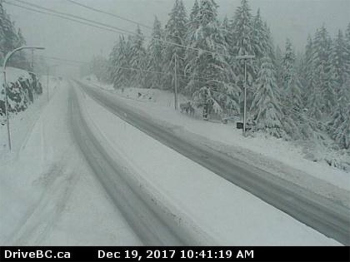
The Malahat Drive, where an estimated 10 to 15 centimetres fell overnight and it was still snowing this morning, was reported to have slippery sections near the summit. Snow was also falling in the mid-Island area:
The changeover to #SNOW started a little earlier than anticipated. Snowing and steadily accumulating in #Qualicum #Nanaimo #Ladysmith PLEASE check @DriveBCroad conditions before heading out and consider delaying non-essential travel #BCstorm pic.twitter.com/bbHRImOT3o
— ECCC Weather BC (@ECCCWeatherBC) December 19, 2017
Sooke Road was closed in both directions for several hours due to downed power lines at Kangaroo Road, but had reopened as of 11 a.m.
OPEN - #BCHwy14 is now open in both direction at Kangaroo Road in #MetchosinBC because Hydro lines are down. https://t.co/GhZsIaTwWV
— Drive BC (@DriveBC) December 19, 2017
#BCHwy14 CLOSED in both direction at Kangaroo Road in #MetchosinBC because Hydro lines are down. No detour available. Estimated time of opening is unknown. Next update 9:00 AM.https://t.co/Zi9Ux7TIEK
— DriveBC VI (@DriveBC_VI) December 19, 2017
North Saanich fire said Tatlow Road was closed:
Tatlow Road closed, between Wain and Alder Road. No estimate for reopening. #nsfire #yyjtraffic pic.twitter.com/RtvFun4V4O
— North Saanich Fire (@dns_fire) December 19, 2017
While most of metro Victoria saw only driving rain, more winter-like conditions, including more snow at higher elevations, is expected later today to be followed this week by cool conditions.
“Get those down jackets out and replenish the firewood stocks,” advised Environment Canada meteorologist Matt MacDonald.
Another blast of winter weather is expected this afternoon as a storm sitting off the Island’s west coast tracks toward the northern part of Washington state.
“The storm’s going to track along the international border there and it’s going to be sucking cold air out of the Interior. We’ll see the temperatures gradually decrease as the rain intensifies, so by Tuesday afternoon we’ll probably see that rain start to become mixed with snow,” MacDonald said.
Another five centimetres of wet snow could fall over higher elevations like the Malahat in the evening, he said.
The snow will taper off about midnight and there will be a bit of a reprieve as sun shines Wednesday. But another snowfall is expected Thursday, MacDonald said.
“We get a nice break on Wednesday. We see the sun come out, so it will be a nice crisp, clear day and then we’re looking at the arrival of some arctic air on Thursday.
“Any time arctic air spills out from the Interior and over to Vancouver Island, we see the potential for what we call strait-effect snow,” he said.
“This colder air comes screaming across the Strait of Georgia, picks up humidity and generates flurries and sometimes snow squalls.”
MacDonald said it’s difficult to predict either how much snow will fall or to pinpoint exact locations where snow will fall Thursday, as those are more matters of proximity to the ocean than elevation, he said.
“These snow streamers, as we call them, are very intense bands of intense flurries. If you happen to find yourself underneath one of these things, it can easily mean five to 10 centimetres in just a few hours.
“But if you’re adjacent to one of these on the side, you might only see a few light flakes.”
The east side of Vancouver Island from Campbell River to Nanaimo, and possibly into Victoria, is most likely to see the snow.
“Victoria is a little less prone to strait-effect snow. It’s typically really the true east side of the Island so from Nanaimo northwards, but the potential is definitely there for Victoria to see, probably, some lighter snow. Typically in this type of scenario, it’s like Comox to Nanaimo that gets heavily hit,” he said.
Once the arctic air arrives, it looks like it’s going to stick around, he said.
“It’s going to be beautiful. It will be sunny but crisp. Friday we’re only heading for a high of plus 3 and the overnight low will be closer to minus 5 and that’s about seven degrees below normal for this time of year,” MacDonald said.
“So any snow that does fall will likely hang around because we’re going to be in these cold temperatures right through Christmas and probably through the new year.”
Historically, Victoria has about a 15 per cent chance of experiencing a white Christmas, the lowest in the country next to Vancouver.
“This year I think that’s a pretty fair bet given the weather forecast going forward, particularly for metro Victoria. I think for east Vancouver Island and any areas inland … those people have a way better chance of seeing snow. But for the city of Victoria and the low-lying communities, I might bump that up to 20 or 25 per cent chance for a white Christmas this year,” MacDonald said.
bcleverley@timescolonist.com


