The Metro Vancouver weather forecast includes a blast of bone-chilling Arctic air and plenty of snowfall this week.
Environment Canada issued a special weather statement on Sunday, Jan. 7, warning locals about a "wintry mix of weather" that includes a series of storms through Tuesday.
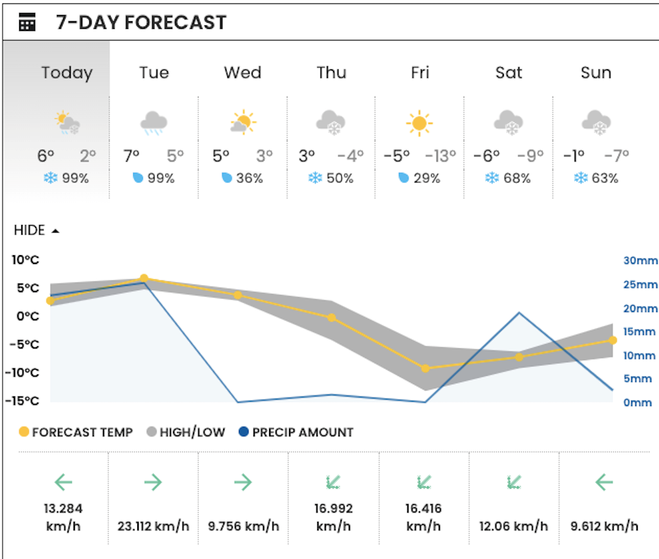
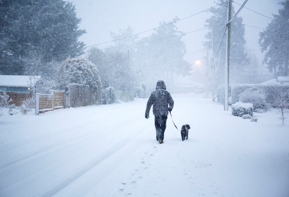
Wet snow began falling across the Lower Mainland early Monday morning, with temperatures recorded at 3 C around 9 a.m. at V.I.A.'s Downtown Centre Weatherhood station. However, this temperature may feel more like -2 C with the windchill.
Wet snow is expected to transition to rain in the afternoon but stormy conditions are expected to persist through the night.
Environment Canada meteorologist Alyssa Charbonneau told V.I.A. that places at higher elevations, such as the Sea-to-Sky, Howe Sound, Squamish, and even eastern parts of the Fraser Valley, will have snowfall warnings through Tuesday night.
Powerful southwesterly winds gusting 70 to 80 km/hr are expected overnight across Metro Vancouver and into Tuesday morning. There is a risk of thunderstorms during the windstorm, too.
While a wind warning hasn't been issued yet, the national weather forecaster will watch closely to see if conditions worsen.
Metro Vancouver weather forecast includes a shift to bone-chilling cold, possible snowfall
Tuesday night through Wednesday should offer a brief reprieve before stormy winter weather resumes in the region.
"We are looking at that Arctic front to bring Arctic air down through the interior of B.C.," Charbonneau explains, noting that the cold front will bring temperatures multiple degrees below seasonal averages.
Temperatures should drop to at least -8 C but could drop below -11 C by the end of the week overnight on Thursday and Friday. Daytime highs aren't expected to climb above freezing on these days, either.
According to V.I.A.'s Downtown Centre Weatherhood station, temperatures could get as cold as -13 C overnight Friday, with temperatures only rising to a high of -5 C during the day.
While the forecast includes the possibility of snowfall on each day starting on Thursday and continuing through the weekend, the probability "is very uncertain." However, cold Arctic air and moisture are the necessary ingredients for "widespread snowfall" in Metro Vancouver, Charbonneau notes.
People headed on the BC Ferries, on road trips, or to Vancouver International Airport (YVR) will want to monitor the forecast closely. Winter storms are unpredictable and make conditions dangerous for travel.
B.C.'s highways, such as the Coquihalla and the Sea to Sky, have snowfall warnings, with the former expected to receive as much as 50 cm by Wednesday.