
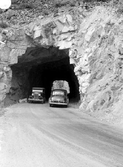
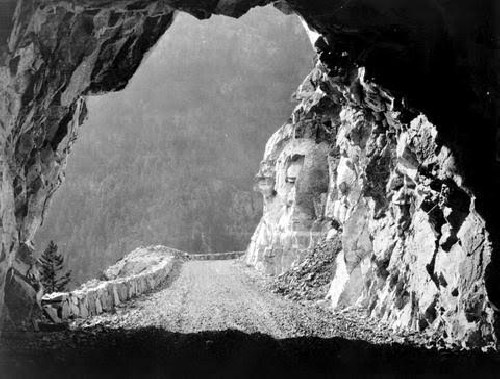
The Cariboo Wagon Road was the route to Eldorado. The Fraser Canyon silt and hills, slick with minerals. Rumour spread quickly that panners could pull out thumbnail-sized gold nuggets. Only they weren’t rumours—the stories were real. The road has existed in several incarnations: the original wagon road in the 1860s, as access to the Canadian Pacific Railway in the 1880s, to the Fraser Canyon Highway in the 1920s, and now as the Trans Canada Highway.
 Courtesy of BC Archives.
In 1858, the California Gold Rush was in a recession. The state, full of miners, hungry for another boom. That spring, they got it. Soil samples sent to San Francisco from mining towns near Quesnel, BC were packed with lucrative minerals.
With nothing left to lose, the men, and a few working women headed north. Less than a month later, Victoria (once a town of only a couple hundred) was a tent city of over 30000. To set up the infrastructure and keep watch on the situation for the Crown, Royal Engineers (military) arrived in BC, August of 1858.
It was by no means a simple task to get to the gold fields. Miners would have to file for a license in Victoria, then carry on to New Westminster to purchase supplies and access the Fraser. These tent-city influxes allowed Victoria, New Westminster, and ultimately the province to start building up its towns. This overnight change is called a “Boomtown,” and the west coast is littered with them.
It’s important to note that the land on which Victoria stands was once a Songees Village. When Fort Victoria was built, the village moved across the Harbour. The land on which New Westminster stands was a trading hub and gathering place for thousands of years. City locations are never just a coincidence. Both places were already desirable, much before the Gold Rush.
 Courtesy of BC Archives.
The sudden growth of people is what really started the province we know today: the first spark of the cities and settlers who built up Vancouver. The miners funded industry and development along the Fraser—prompting people to settle not in the gold fields, but right here, in the Lower Mainland and on Vancouver Island.
I’ve always loved the term “mining the miners,” and that’s just what the cities did. Most people left the Cariboo penniless, but business owners prospered, selling food, supplies, and transportation.
If you’re interested in this narrative, I recommend visiting Irving House in New Westminster, a victorian home built in 1865—with the money raised from William Irving’s successful steamship business. His sternwheelers brought miners up the Fraser, to Yale: the start of the Cariboo Wagon Road.
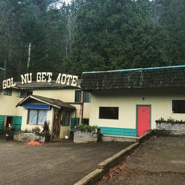
Boomtowns also went beyond the lower mainland. Today, Yale is small, but by no stretch a ghost town. It remains a gateway to the gold rush, and although it has seen busier days, maintains a small tourism hub. Most known for whitewater rafting trips on the rapids that stopped steamships, and ultimately made the wagon road necessary. As well as a place to fill up gas tanks before starting the long, winding drive to the middle of the province.
 A highlight of Yale. 2015.
In the late 1920s the wagon road was transformed into the Fraser Canyon Highway—you can still see the old Highway and its tunnels in parts. The most exciting stretch is only two hours outside of Vancouver.
Just past Yale sits Alexandra Bridge, the start of the Wagon Road when it was built in 1862 (eventually washed out in the great flood of 1894). The bridge that stands today was built in 1926 for the old Fraser Canyon Highway. With the completion of the Trans Canada Highway in the 1950s, the bridge fell out of use, and car access stopped completely in 1964.
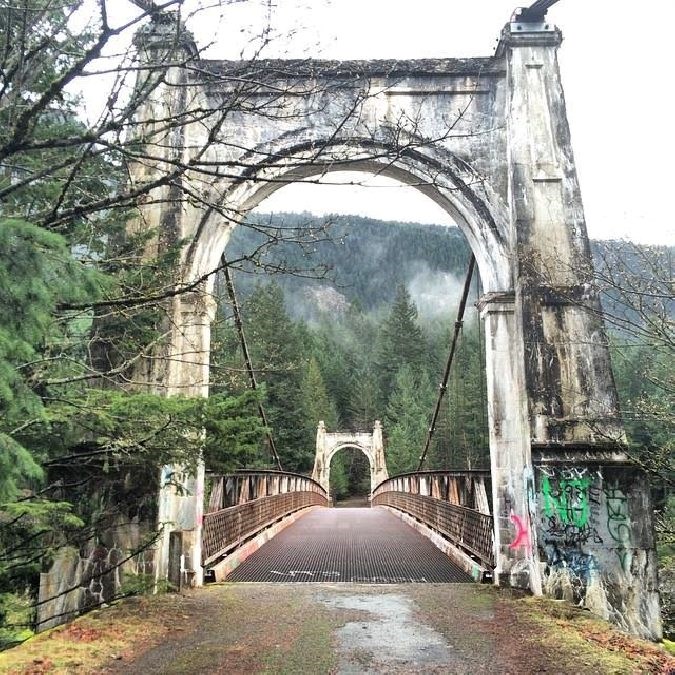 Alexandra Bridge, 2016.
The bridge itself is pretty unkind to anyone afraid of heights—it’s open-grate for snowfall, and the concrete pillars, although sturdy, are definitely missing pieces. Risk aside, try to listen for passing cars through the brush, and rushing water beneath, because where you’re standing is where it all started. And please, be sure to read some of the graffiti. There are always a few good ones!
Once you’ve listened, read, and crossed: keep hiking. You can’t get more than an hour and a half down the road. You’ll find old cars, cabins, and if you’re really lucky, a “Garbage Gobbler.”[embed]https://www.youtube.com/watch?v=5FDSifqPslc[/embed]
Alexandra Bridge is a truly important and stunning place. The Cariboo Wagon Road deficit played a huge role in our joining confederation. The Canyon hosted a war between aboriginals and miners, which changed legislation forever. The existing structure made the railway more affordable. It provided access through the mountains. Connected us to the people and resources the land had to offer. And, it enabled us to stay long enough to grow the city we love.


