In 2014, Seattle's Peter Gorman embarked on an epic adventure: A 11,000-mile solo bicycle ride around the U.S. starting in Boston, and including a stop in Vancouver.
When he was done, Gorman started turning some of the more practical parts of his ride--namely the maps--into artwork. The result is Barely Maps, a collision of graphic art and travel geekery.
Gorman has been releasing artwork illustrating well-traveled intersections in the places he's visited, and he's just put out one showcasing Metro Vancouver.
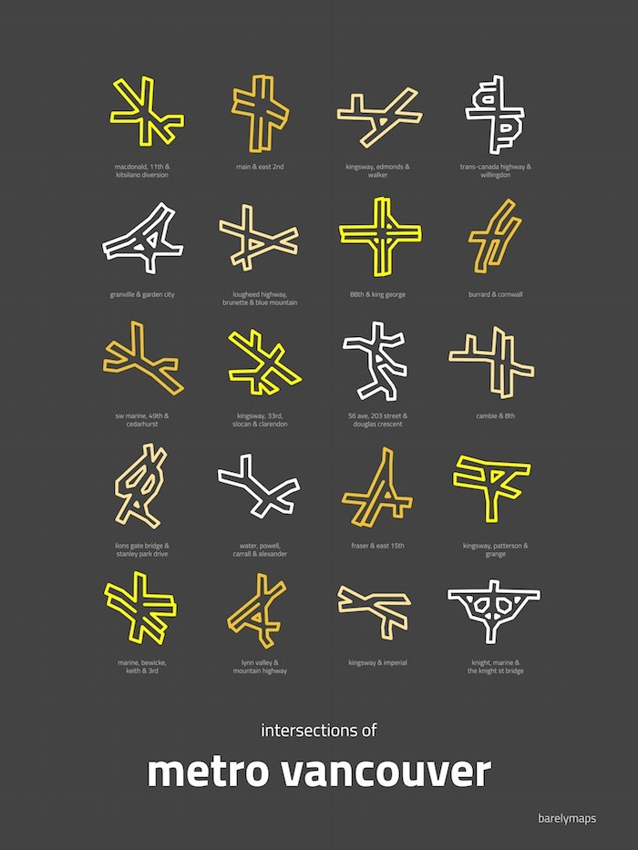 Intersections of Metro Vancouver by Peter Gorman
While we might drive, bike, or walk these intersections regularly, they take on personalities of their own in these graphic renderings. Among the intersections Gorman features in his Metro Vancouver map are Cambie and 8th Knight, Marine and the Knight Street Bridge; and Lions Gate Bridge and Stanley Park Drive.
Incidentally, that Knight, Marine, and Knight Street Bridge spot sees the most traffic accidents, according to ICBC.
Gorman tells V.I.A. in an email that this Vancouver map is particularly exciting for him because it's the first Canadian city he's mapped, and one of his major stops on his epic bike trip.
Other cities getting the intersections map art treatment include Chicago, Boston, Portland, San Francisco, L.A., Austin, and Gorman's hometown of Seattle.
If you want to add Gorman's "Intersections of Metro Vancouver" to your collection, it's available in three sizes: 8x10 ($33.74), 11x14 ($40.49), and 13x19 ($51.29) via his Etsy shop.