
 Photo: J Uppal / Twitter
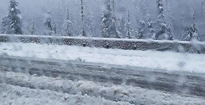
Environment Canada has issued weather alerts for a number of B.C. highways as cold Arctic air surges through the mainland inlets and valleys.
The forecast predicts that extremely strong winds will spread south towards Howe Sound and the Fraser Valley this afternoon. As such, the Sea to Sky Highway from Squamish to Whistler will see wind chill values reach minus 20 overnight as well as into Saturday morning.
What's more, the forecast warns that any outdoor activity exposes you to an increased risk of frostbite. As a result, you should be prepared for unusually cold temperatures and strong winds.
Further, drivers are warned to exercise care, especially along coastal routes exposed to outflow winds. Weather in the mountains can change suddenly resulting in hazardous driving conditions.
What's more, other areas of the province, such as the B.C. Peace River, Bulkley Valley and The Lakes, Cariboo, Yoho Park, Kootenay, North Thompson, and North Columbia, McGregor, Elk Valley, Chilcotin, and Kinbasket will see extreme cold.
A cold arctic airmass has settled over the BC Central Interior, and the combination of cold temperatures and brisk winds produces wind chill values near minus 40 overnight. Risks are greater for young children, older adults, people with chronic illnesses, people working or exercising outdoors, and those without proper shelter.
With that in mind, conditions are expected to warm Saturday afternoon.


