
A 6.2 magnitude earthquake struck off the B.C. coast Wednesday, July 3 followed by a second earthquake with a 4.0 magnitude.
The first, which is the strongest earthquake in B.C. this year, hit the Haida Gwaii archipelago region in the evening. The U.S. Geological Survey says the first earthquake hit around 9:30 p.m. local time.
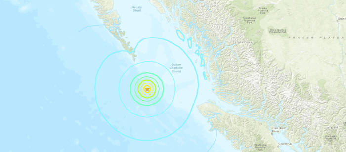 Photo: US Geological Survey
Further, it reports that the quake's epicentre was 196 kilometres west-southwest of Bella Bella at a depth of 10 kilometres.
Earthquakes Canada says the tremor was "lightly felt" on northern Vancouver Island and the adjacent mainland coast. They also report that the earthquake was less powerful, with a 5.8 magnitude. In addition, they state that the quake was located 353 kilometres southwest of Kitimat, B.C., and 581 kilometres west-northwest of Vancouver.
Earthquakes Canada also reported a second earthquake a few hours later near the Port Hardy region. It registered a 4.0 magnitude on the richter scale.
Automatic detection of seismic event: magnitude 4.0 - 3 Jul 22:55 PDT - PORT HARDY, BC region
— Earthquakes Canada (@CANADAquakes) July 4, 2019
There was no tsunami warning issued and officials are reporting no threat of landslides.
With files from the Canadian Press.


