
 Lightning bolt/Shutterstock
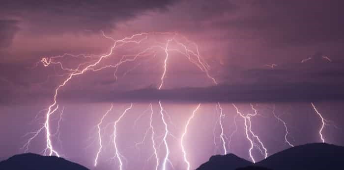
The Metro Vancouver weather forecast is calling for decidedly stormy weather as a strong Pacific frontal system brings heavy rain into the region.
Environment Canada issued a special weather statement on Aug.1 for the following areas:
- Metro Vancouver - northeast including Coquitlam and Maple Ridge
- North Shore - including West Vancouver and North Vancouver
The Pacific frontal system will tap into subtropical moisture which will amplify the front and help to enhance the rainfall. As the front continues, the forecast calls for showers on Thursday night with a risk of thunderstorms and gusty winds through Friday. However, there is, "uncertainty with respect to the location of where the heaviest precipitation amounts will occur."
The continuous rain will end overnight or early Friday morning as the front pushes to the east.
Metro Vancouver Weather Forecast
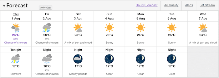 Photo: Environment Canada
British Columbia saw an impressive 17 weather records broken across the province on Wednesday, June 13 due to a very strong ridge of high pressure.
The Vancouver Area broke its previous record of 27.4°C set in 1999 with a toasty high of 29.1°C. Similarly, the White Rock Area set a new daily high of 30.9°C, which broke its previous record of 29.4°C set in 1932.


