
Vancouver's tourism industry in 2023 is one of the major drivers of the economy.
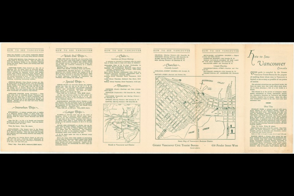
In 1923 it wasn't as big as it is now, but the city still drew visitors from around the world, thanks to being located on Canada's western shore. To help guide those arriving here, the Greater Vancouver Tourist Bureau published information (this was pre-Google Maps by a few years) like this travel brochure from 1923.
Titled "How to See Vancouver" it has all the major highlights. And to help tourists plan their trips, it's helpfully broken down into a day-by-day itinerary, so long as they want to stay around for nearly two weeks.
"This Bureau is at the service of strangers," notes the brochure. "Maps, guides, information on hotels, apartments, resorts, etc. descriptive literature on Vancouver and British Columbia, supplied free of charge."
It goes on to suggest mail be addressed to the bureau's office.
The top sight at the time is a sightseeing trip through Stanley Park. The oldest park in Vancouver was nearly 40 years old at the time and provided a mix of manicured parkland and wild spots, including the hollow tree and Brockton Point. However, the aquarium and even the Lions Gate Bridge were years in the future.
A tour around Marine Drive is also suggested for a visitor's first day in the city, with highlights including the vista across the Strait of Georgia, which is still popular today. Plenty of sights on the list are gone now, and probably wouldn't rank high if they were still around, like the Government Wireless Station and the Government Aerodrome.
Over the days the tourism bureau also suggest people check out the library (located at Main and Hastings at the time), the museum (located in the same building), and the local war memorials.
Vancouver's multicultural character was already established to some extent by 1923 (though some problematic language is used). The brochure suggests checking out the Japanese and Chinese districts or the Sikh Temple in the city.
However, the only reference to Indigenous peoples is a mention that steamships travelling north stop at First Nation villages. No mention of First Nations people or history in Vancouver is made.
Vancouver's natural beauty (particularly North Vancouver) and exploration are played up to a great degree as well, with trips to Capilano and Lynn Valley canyons suggested (the Capilano Suspension Bridge was already a popular tourist attraction by this time), along with Grouse Mountain and other locations.
With few tourism sights in the city built up, the towns around Vancouver are also suggested as their own destinations for day trips, including Port Moody (a ferry is suggested), Chilliwack (the electric railway made it that far in the 1920s) and Bowen Island (attainable via steamship).
Aside from the day-by-day tips, the brochure also includes a few other highlights, like local theatres for both stage and "moving pictures" (the Orpheum was in its vaudeville era), churches (only Christian places are listed) and clubs (as in the local Kiwanis, Lions, and Automobile Club of B.C.).
To see the full-size image files of the brochure, side one can be seen here and side two can be seen here.
If you want to check out the archives yourself from home, you can search their digital holdings online.


