
While the City of Vancouver has existed for over 135 years, there was plenty here before.
These eight maps capture some of that, though purely from a settler/colonial perspective as they were created by explorers and governments.
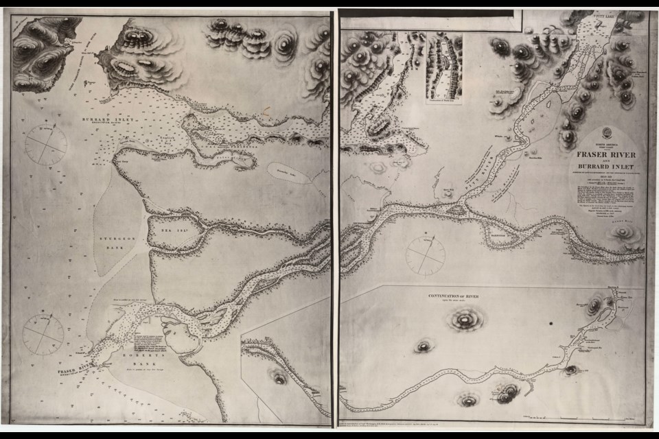
The earliest, which was made by Captain G.H. Richardson and the officers of H.M.S. Plumper over 1859 and 1860, according to the City of Vancouver Archives, is an incredibly detailed piece of work, especially along the shores that the ship would have traveled. Along with topography and settlements, it shows the depths ships would need to know as they sailed up the muddy Fraser.
At the time the Lower Mainland wasn't a particularly dense area, as far as human population goes by today's standards. New Westminster is marked, as are two Langleys (Old and New). A village attributed to the Katzie First Nation is also note, though misspelled. Other settlements are noted, including Hastings Mill.
Not everything has been explored by Europeans at the time the map was made, there's body of water lightly drawn in near where Munro Lake should be noting local Indigenous people report a lake "abounding with Sturgeon" in the area.
The other maps build upon this, with more and more structure.
The next oldest is also a wide view of the area, noting forts located across what would later become southern B.C. It's also from 1860, so the only locations in notes in the Lower Mainland are New Westminster and Derby (the newer Fort Langley). It's maybe most notable for what doesn't exist: Vancouver, Kelowna (and really most of the Okanagan settlements) and Whistler are all missing.
From there the maps move into more localized townsite planning. One, which originates from 1869 is for the Hastings area, which didn't even have road names at the time.
The next map is similar, but for the 'Town of Granville.' It shows lots in the precursor to Vancouver. It captures the area between Hastings Street and the Burrard Inlet between Cambie and Carrall streets. Outside of the dotted townsite land the government claims the right to "dispose of" however it wants.
A third showing lots is actually from what is now Richmond, along the north arm of the Fraser River. It captures the names and uses of some of the lots there, including a church and roads to False Creek and New Westminster.
Speaking of New Westminster, as the most notable settler town in the Lower Mainland, the area was knonw as the New Westminster District in 1876. Another maps shows how the land was broken up according to the district government. At this point the Hastings and Granville townsites are noted, as are reserves for the government and First Nations.
Another map, from 1885, is one of the few that actually gives details about locations in one of the townsites. It's an insurance map of Granville and shows what structures were in the town of 300. That includes the Granville Hotel, Deighton Hotel and, in an inset, Hastings Mill.


