
If you weren't near the ocean on Saturday, Nov. 6, you may have missed a massive weather phenomenon spinning off the shore.
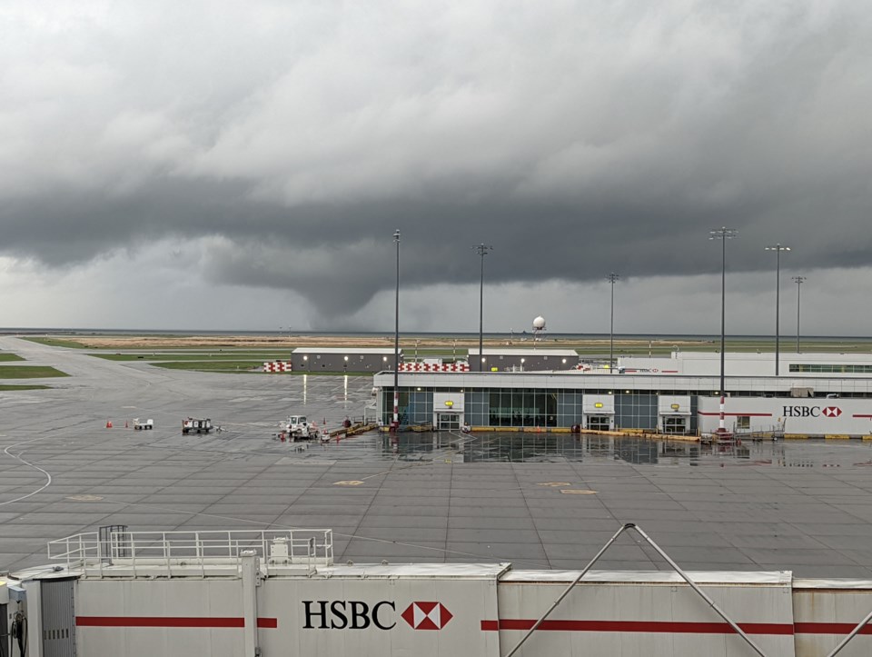
Around 5 p.m. Environment Canada detected a water spout, or a tornado over the water, says meteorologist Bobby Sekhon. To those at Vancouver International Airport or near Richmond and Vancouver's ocean shores, it looked like a huge spinning cone, as many people captured video and photos of the moment.
"Waterspouts are not that rare in the Strait of Georgia," Sekhon says. "We see them every year. They're usually quite thin, short-lived and usually not overly damaging."
Saturday's spout didn't cause any damage, as far as Sekhon knows, it was much larger and more visible than the usual tornados in the area, be they over water or land.
"A lot of things had to come together to get it to this size," he adds.
And a lot of people captured that scale.
Meanwhile, Sekhon says Environment Canada is also investigating whether a tornado touched down on land at UBC.
While there was definitely a wind event at the school which resulted in a significant power outage and many trees crashing to the ground, whether it was a tornado or not is still being determined.
"We have to look at different types of data, radar, satellite," he explains. "And then we have to determine what type of wind event that might have been. There can be non-tornadic wind events."
What happened at UBC may have been a straight-line wind event; tornados spin, straight-line events are...straight.
Experts will assess the damage and data and make the declaration at a later date he says.
In any case, he has some advice for what to do if you find yourself facing off with a twister.
"What you want to do is get into a basement or main level of a house," he says. "Somewhere with a sturdy structure and no exterior windows."
A special weather statement has been issued for early this week, with high winds expected Monday night and Tuesday, but he says the while gusts may get into the 90 km/h range around the Lower Mainland, the conditions are not right for tornados anymore.


