
 Vancouver snow / Shutterstock
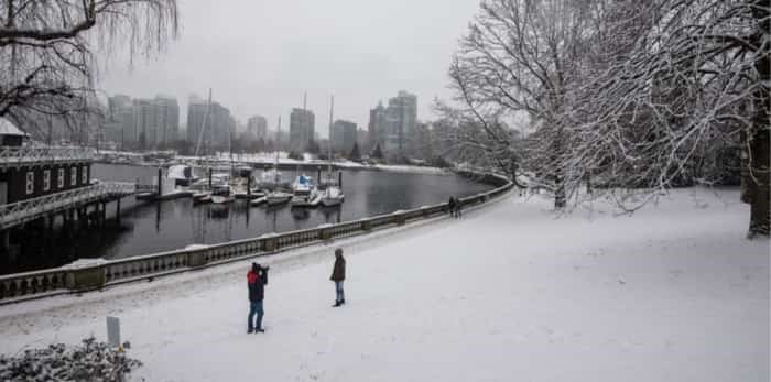
The Vancouver weather forecast has been calling for snowfall this week, but a recent update predicts that the region will receive more snow than previously expected.
Yesterday, Environment Canada forecasted that Thursday had a 30 per cent chance of flurries or rain showers during the day, with Thursday night seeing a 60 per cent chance of flurries. Following this, Friday had a 60 per cent chance of flurries or rain showers during the day.
As of February 6, the forecast calls for a 40 per cent chance of flurries on Thursday night. Following this, Friday's forecast calls for periods of snow all day long. As a result, there is a much higher likelihood that the snowfall will accumulate.
In fact, the forecast states that most areas, "will receive at least a few centimetres of accumulation by late Friday." With this in mind, particular areas, such as the Fraser Valley, will receive the greatest amount of snowfall.
The forecast also calls for Sunday to see cloudy periods with a 60 per cent chance of flurries during the evening.
What's more, the forecast states that there will be, "Bitterly cold arctic outflow winds Friday night and Saturday."
Vancouver Weather Forecast
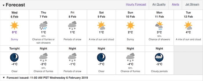 Photo: Environment Canada
The forecast states that the snowfall will begin to ease on Friday night, as the bitterly cold winds pour out of the mainland inlets and valleys. It also notes that particular areas, such as over the Howe Sound-Whistler and the Fraser Valley, will see bitterly cold windchill temperatures as well as reduced visibility in blowing snow.


