
The Sea to Sky highway is one of the most famous pieces of pavement in B.C.
With its winding route along the coast and up into the mountains, it's a popular drive. While today it's a well-engineered highway capable of whisking lots of people away from the city, back in the mid-60s it wasn't so robust.
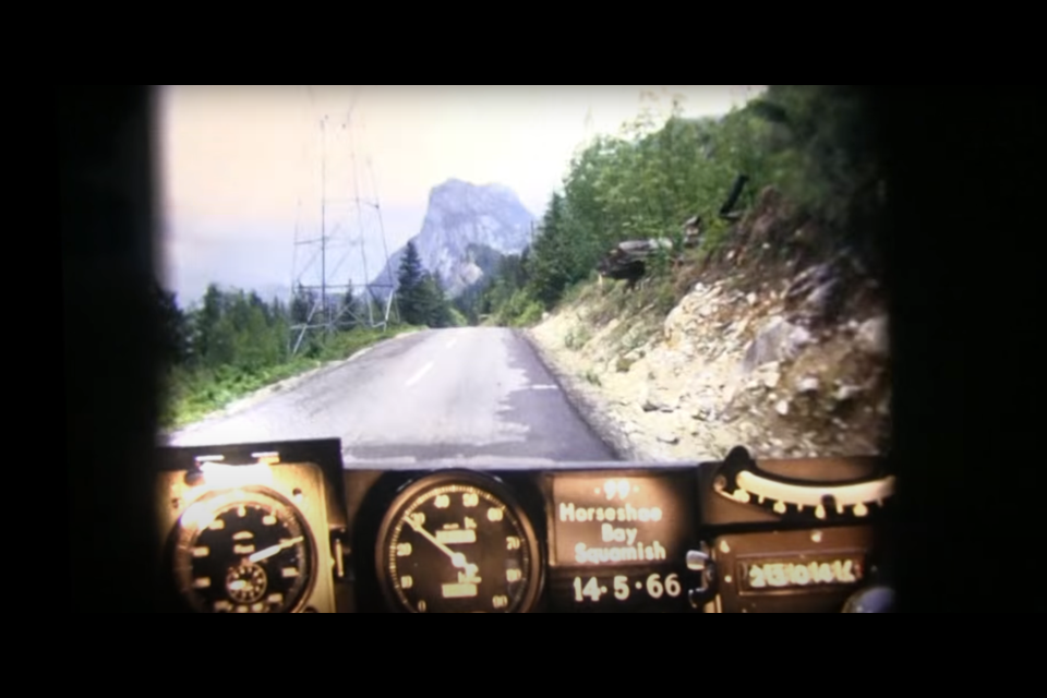
This archival video shared by the Ministry of Transportation takes viewers from Horseshoe Bay to Squamish on Highway 99 in 1966. It doesn't quite make it to the "Sky" part as there wasn't really much past Squamish; Whistler Mountain, the "sky" destination, opened up in 1966 as part of a bid for the 1968 Olympics, but was only serviced by a gravel road which had just been built, and hadn't reached Pemberton yet.
While the route seems similar to the current highway, it seems to hug the coastline much more than the current highway appears to. And while the odd industrial site can be spotted (notably what looks to be Britannia Mine at the 2:47 mark) there's not much human activity (aside from traffic) until Squamish.
The importance of the Britannia Mine may be a factor in the quality of the road, which declines quickly after the video rolls past the historic location. The road also gets narrower and the double yellow turns to a dashed line to allow passing on the windy road. Signs at this point indicate the speed limit is 30 miles per hour.
Around Squamish, there's more activity, with crews out working on the road in one spot, and then you're in Squamish, rolling through the center of the bustling community.
Aside from the time-traveling tour of a famous piece of B.C. infrastructure, there's a chance this is the first instance of a dashcam catching a traffic violation. At around the 1:15 mark of the video you can watch a blue sedan pass another blue sedan on a double yellow line.
If you watch in slow motion you can see the passing vehicle barely make it back over in time before an oncoming car zooms past.
The video continues past Squamish and into a more rural area, but peters out. According to a blog post from the ministry that's where the pavement ends and a gravel road begins.
"In 1966, there was no paved provincial highway connecting Squamish and Whistler (then Alta Lake). Our photolog for this route ends after Squamish, where a narrow gravel road continues on," they write.
The photologs were a series of pieces created by the province to catalogue the highway system. They'd strap a 16 mm film camera to a car's dashboard and rigged it so it'd take an image every 80 feet or so. This created a sort of time-lapse or stop-motion version of the highway drive.
"As far as we know, the 'Highways Department' (as it was then known) was the first organization in Canada to collect information this way in order to create a visual record of road condition information from across the province, thereby allowing our engineers to study a stretch of road without having to travel there," states the ministry.


