
These maps all share something, but each one is unique as well.
They're all historic maps from atypical perspectives. One's a bird's eye view from East Vancouver, another is a drawing of the view from Grouse Mountain and the third is from somewhere over Richmond.
While Google Maps and the growth in aviation means views from high above the city are more common now, these maps all predate computers, and, in one case, motorized aircraft.
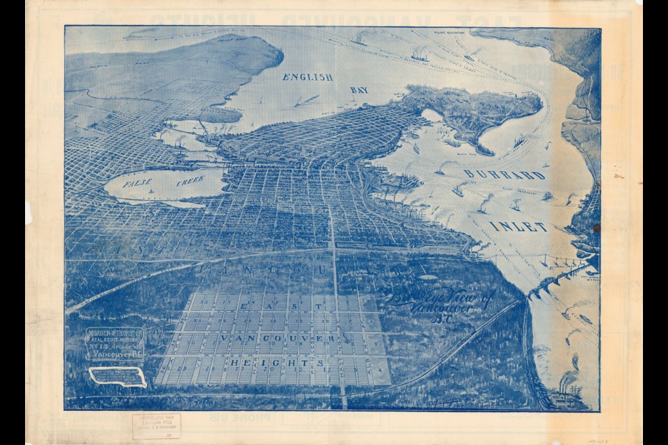
The oldest map of this set is from 1907 and it's not a tourism map or something created for drivers (often the reason people use maps these days). Instead, it shows a real estate development. While the development is called East Vancouver Heights it's actually just outside of the City of Vancouver proper and lies in Burnaby. Some of the streets have changed names, but you can use the intersection of Madison Avenue and Hastings Street as an anchor point.
With the bird's eye perspective, the artist really shrinks the distance from Burnaby to Vancouver. However, it does allow them to include lots of details from the young city, which was just over 20 years old at the time.
Some highlights include False Creek before it was dammed (with the Westminster Avenue bridge crossing it, which later became Main Street), shipping lines noted with destinations ranging from Squamish to Fiji), and lots of little details along the Burrard Inlet shoreline with smokestacks and ships.
The map from 1925 looks down on the city from Grouse Mountain, a view common on Instagram these days, but less so 100 years ago.
Like the previous map, it has a fairly detailed artistic interpretation of Burrard Inlet's south shore. Areas further south are a bit more blurry. One feature this map has that the others don't is a guide to what you're able to see, using a grid (even though the perspective is tilted). It marks out where landmarks like the aerodrome, Second Narrows drawbridge and public booming grounds are. None of those exist today.
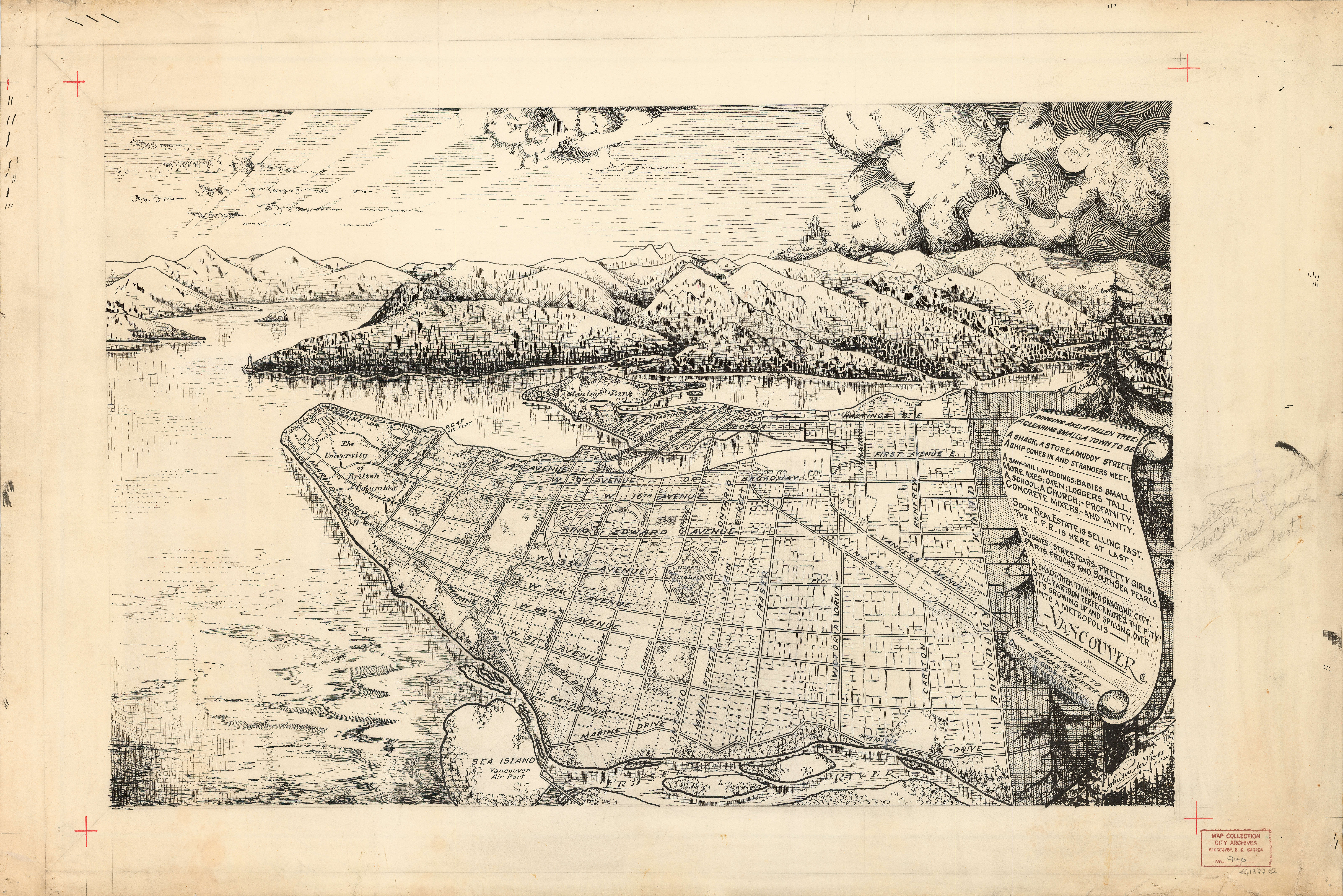
The most recent, from 1940, is also probably the least accurate. The artist used the perspective of someone hanging over Richmond's north shore from the looks of it, with the Fraser River's north arm at the bottom of the map.
This is the most artistic of the three maps, not just because it includes the mountains, clouds and sun as a backdrop. There's also the poem on the right-hand side dedicated to the city. We've written it out below (including the absolutely unhinged use of colons and semi-colons).
A ringing axe; a fallen tree:
A clearing small; a town to beA shack, a store, a muddy street;
A ship comes in and strangers meet.A saw-mill: weddings: babies small:
More axes; oxen; loggers tall:
A school; a church; -profanity:
Concrete mixers,- and vanity.Soon real estate is selling fast,
The CPR is here at last!Buggies: streetcars: pretty girls;
Paris frocks and South Sea Pearls.A shack; then town; now gangling city,
Still far from perfect, more's the pity!
It's growing up and spilling over
Into a metropolis -
VancouverFrom silent forest to bricks & mortar:-
Only the gods know if we'd oughta!!


