

 Photo: J Uppal / Twitter
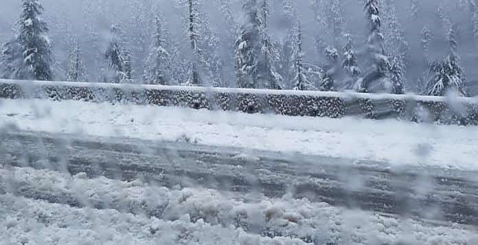
A massive winter storm warning is in effect for a major B.C. highway tonight.
As of Tuesday, December 18, Environment Canada predicted that a moist Pacific frontal system will move inland early in the morning on the Coquihalla Highway on the Hope to Merritt section. Following this, however, a strong southwest flow is predicted to create waves of moisture across the Coast Mountains over the next 36 hours.
Over 17 cm of snowfall fell on the mountains last night near the Coquihalla Summit. While snow was expected in the morning, the snow is expected to intensify midday as the next wave of moisture approaches. Afterwards, the forecast calls for additional snowfall amounts of 15-20 cm in the late afternoon.
Periods of heavy snow are expected to continue into this evening with over 15 cm of fresh snowfall. As a result, the total storm accumulations are predicted to be in the 40 to 50 cm range before the snow eases off on Wednesday.
A winter storm warning has been issued for Coquihalla Highway -Hope to Merritt. Heavy snow is expected tonight. Snow will temporarily ease Tuesday morning, but will return by midday and continue Tuesday night. Find the details here https://t.co/pM5kQgyb7p. #BCstorm
— ECCC Weather British Columbia (@ECCCWeatherBC) December 18, 2018
There was a winter storm warning in effect for the Coquihalla highway last week, too. In fact, an extremely intense Pacific cold front moved across the Coquihalla Highway and brought 15 centimetres of snow and winds with gusts of wind up to 90 km/h.
As a result of the weather in the mountains, driving conditions may suddenly become hazardous. If visibility is reduced while driving, slow down, watch for tail lights ahead and be prepared to stop.


