
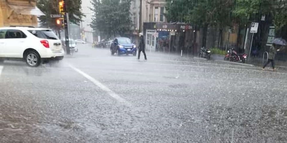
After a brief respite from heavy rain, Environment Canada has issued a rainfall warning for Metro Vancouver as a strong Pacific storm hits the B.C. coast.
Earlier this week, the New Year's Eve forecast included a warning for up to 60 mm of rainfall to fall through Tuesday evening. Now, the the warning states that rain, at times heavy, is expected from later this afternoon through Friday night.
The strong Pacific storm is expected to make its way this afternoon, with prrecipitation spreading onto the south coast by noon. What's more, the forecast notes that rain may be briefly mixed with wet snow in the afternoon.
The storm is expected to intensify later tonight and persist through Friday, bringing 60 to 90 mm of rain over the Howe Sound and Metro Vancouver - central and North Shore. The warning notes that the heavy downpours can cause flash floods and water pooling on roads. Localized flooding in low-lying areas is also possible.
The rainfall warning is in effect for:
- Metro Vancouver - central including the City of Vancouver Burnaby and New Westminster
- Metro Vancouver - North Shore including West Vancouver and North Vancouver
While the rainfall is expected to dimish in intensity by Friday night, rain is expected to expected to continue through the rest of the week. Saturday's forecast calls for a 70 per cent chance of showers during the day and periods of rain overnight, while Sunday calls for rain during the day. However, the evening is expected to be cloudy and dry.
The forecast also calls for periods of rain on Monday, Tuesday, and Wednesday next week.
Metro Vancouver Weather Forecast
 Photo: Environment Canada
B.C. Winter Forecast
Back in September, The Weather Network predicted that British Columbia would have a milder winter, but that December was a “wild card.”
Since then, the winter forecast has been updated to include the most recent prediction, which calls for milder temperatures along the B.C. coast and across much of Northern B.C. While northeastern B.C. to the southern interior will see near normal temperatures.
While the north coast region is, “expected to see above average rainfall and alpine snow,” the south coast region is expected to be drier than normal. With this in mind, the forecast adds that this dry pattern may break at times during the season. During these breaks, the Lower Mainland could have the, “potential to see several weeks’ worth of precipitation in just 5 to 10 days.”
To report severe weather, send an email to [email protected] or tweet reports using #BCStorm.


