
A bomb cyclone threatened to stir up some serious trouble in Metro Vancouver...but it didn't wreak as much havoc as it could have.
A fast-developing storm system had B.C. meteorologists on the lookout towards the end of last week, but they only expected 10 to 20 mm of rainfall to fall in the Lower Mainland.
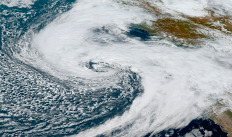
But the tempest drew particular concern as it started rapidly intensifying over the Pacific.
Environment Canada Meteorologist Alyssa Charbonneau said the storm's central low-pressure system was dropping at an accelerated rate, which eventually met the definition of a trending term: a "bomb cyclone."
In order to meet the criterion, a storm's barometric pressure must drop 24 millibars in 24 hours. This typically happens when warm air meets a cold air mass or cold ocean waters. When a storm intensifies this quickly it can produce more intense weather, including heavy rainfall, winds, and thunderstorms.
"When we talk about bomb cyclone, it is a storm system that is rapidly intensifying," explained Charbonneau, noting that this particular storm met the conditions as it intensified over the Pacific but hasn't been intensifying any further over the past 12 hours.
While a "bomb cyclone" has the potency to cause widespread power outages, localized flooding, and structural damage, this storm system diverted away from the B.C. coast. As it moved toward the mainland, it started tracking northward to Haida Gwaii and the Alaska Panhandle.
Metro Vancouver weather forecast following bomb cyclone
Since the storm didn't make landfall, most areas of the Lower Mainland aren't facing a catastrophic windstorm and flooding, although a wind warning is in effect for the region on Monday. Winds gusting 50 km/h to 70 may cause damage and power outages are possible.
If the storm had been tracking over Vancouver Island, locals would have had to brace for a much more extreme weather event. However, it is the first wind storm of the fall season, and therefore "heavy tree branches are more prone to break in strong winds," she noted.
There is a potential for lightning later this afternoon and into this evening with periods of heavy downpours. While they likely won't be as intense, there are some other potentially wet and windy systems rolling into the region on Tuesday and Wednesday.
Toward the end of August, locals shared images and videos of an electrifying storm with booming thunder and flashes of lightning.
Charbonneau underscores that fall weather tends to evolve rapidly and the forecast does, too.
To stay up-to-date on the evolving storm, V.I.A.'s Weatherhood provides detailed, neighbourhood-specific forecasts for places across the Lower Mainland that include hourly, daily, and weekly breakdowns of what to expect. The interactive map allows you to see what areas may be experiencing stormier weather so you can prepare in advance for commutes.


