
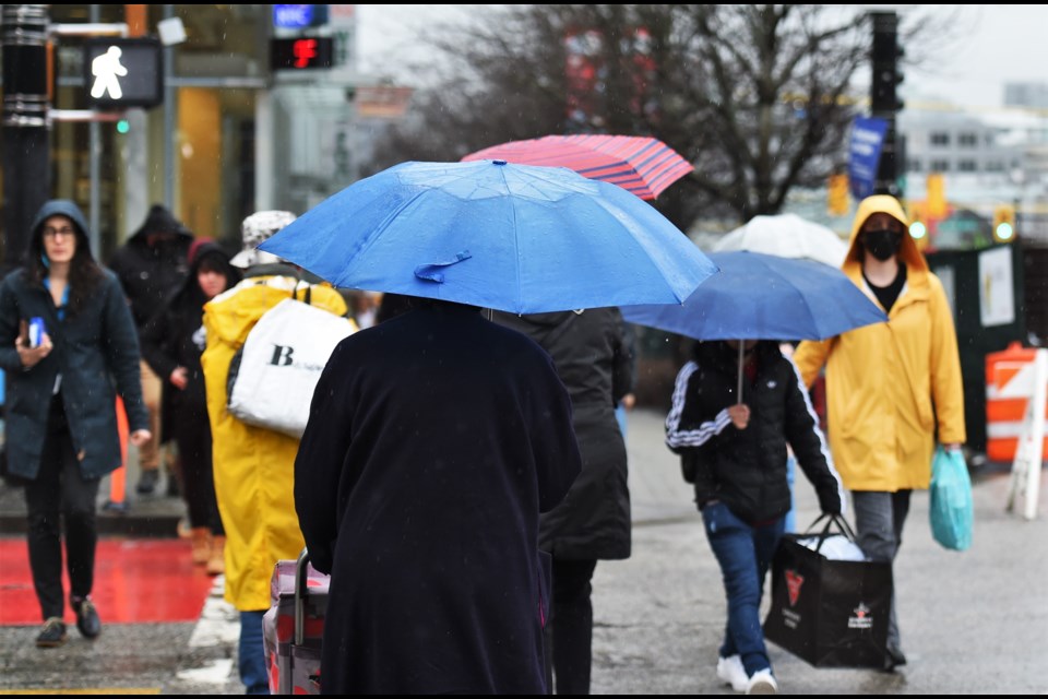
The Metro Vancouver weather forecast includes an impressive amount of rainfall -- and that's before the region gets drenched by an atmospheric river.
Environment Canada has been tracking a tropical storm that's been on course to impact the Lower Mainland for several days now. The tempest originated near Hawaii, which makes it a "Pineapple Express."
While there was some uncertainty about when the storm would hit and how much of an impact it would have, the department issued a special weather statement on Friday morning (Jan. 26), clarifying that the event should commence Saturday and last through Tuesday and possibly Wednesday.
Meteorologist Alyssa Charbonneau told V.I.A. that atmospheric rivers are "narrow bands of heavy precipitation" and can include a series of small storms. Rather than impacting the region all at once, the moisture will be experienced over several days.
But it looks like the day of heaviest rainfall will come ahead of the anticipated event.
Roughly 20 to 30 mm of heavy rain is expected to fall on Friday night across a large portion of the Lower Mainland -- and "ironically" this storm isn't part of the atmospheric river, Charbonneau described.
Instead, it looks like the areas most impacted by the atmospheric river will be the local mountains; some places in the region might not experience torrential rain in the coming days.
That said, it won't exactly be dry around Metro Vancouver.
"As we get into Saturday and onward, there will be a big range of precipitation. Totals over five days: West Vancouver and the North Shore could see 100 to 150 mm of precipitation, while other areas could have 60 to 120 mm," she said, emphasizing that most areas will see "pulses of heavy rain" rather than a nonstop downpour.
Following Friday's wet weather, the heaviest rain is expected on Sunday and Monday.
Metro Vancouver weather forecast includes "spring" temperatures
Temperatures are also tracking to hit several degrees above the seasonal average, peaking 5 C to 10 C above normal in the coming days. Sunday through Tuesday could "feel like spring," although it will be wet, Charbonneau noted.
Daily highs average around 7 C for this time of year but the high could reach a jaw-dropping 15 C by Monday. Additionally, overnight lows aren't expected to dip below the double digits, sitting between 11 C and C.
Those lows "are close to breaking daily temperature records," she said.
Since temperatures will climb to daytime highs above double the seasonal average, freezing levels will soar, resulting in a significant thaw in the local mountains. The melting snow and ice will contribute to the risk of flooding.
Freezing levels will rise to approximately 2,000 metres on Friday night and continue to rise to between 2,500 to 3,000 metres. These elevated freezing levels will persist into mid-next week.
Travel conditions could also be hazardous due to water pooling and possible landslides in vulnerable areas (such as burn scars) "due to heavy rain falling on already very saturated surfaces."
There is also a potential for falling tree branches and power outages due to strong winds and saturated soil.
A flood watch has been issued by the BC River Forecast Centre for the South Coast including the Howe Sound, SunshineCoast, Sea-to-Sky and the North Shore Mountains, as well as the Fraser Valley tributaries from Port Coquitlam to Harrison.
Stay up-to-date with changes in expected precipitation across 50 neighbourhoods in the Lower Mainland with V.I.A.'s Weatherhood.


